Operation Desert Storm Gulf War Map Patch
- SKU:
- 10402
- MPN:
- 10402
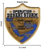
- Width:
- 3.50 (in)
- Height:
- 4.00 (in)
- Depth:
- 0.08 (in)
- Backing:
- Iron On
- Edging:
- Merrowed Edge
- Era:
- Persian Gulf War


Description
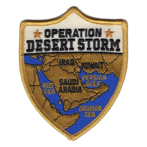
Kuwait, the country the whole war was fought over, has no name stitched on this map, just a small tan corner at the head of the Persian Gulf under IRAQ. The big players are lettered, from Egypt, Sudan and Ethiopia along the Red Sea to Iran and Afghanistan across the top. That is the ground the coalition worked across in 1990 and 1991, from the ports and airfields of Saudi Arabia to the ships on station offshore. Operation Desert Storm opened in the early hours of January 17, 1991, and this patch puts the whole map inside a shield you can hold in one hand. It was made for people who can still point to the spot on it where they were.
Iraq invaded Kuwait on August 2, 1990, and Operation Desert Shield began five days later to defend Saudi Arabia, with the XVIII Airborne Corps and the 82nd Airborne Division among the first to move. The buildup passed 600,000 U.S. personnel once VII Corps came down from Europe with its armor. On the first night of the air war, eight AH-64A Apaches of the 101st Airborne Division, flying as Task Force Normandy, knocked out two Iraqi early-warning radar sites, F-117A Nighthawks hit targets in Baghdad, and more than 100 BGM-109 Tomahawks went out from ships in the Persian Gulf and the Red Sea, USS Wisconsin BB-64 and USS Missouri BB-63 among them. The ground war started on February 24, and while the 101st flew deep into Iraq, the 24th Infantry Division drove some 200 miles north to the Euphrates River by noon on the 26th. Coalition ground forces finished the job in under 100 hours, and a ceasefire was declared on February 28.
The patch is a 3 by 4 inch shield with a tan merrowed border and a white band across the top, where OPERATION DESERT STORM is stitched in tan between two small stars. Below it the Arabian Peninsula sits in sand-colored thread on blue water, with black lettering for SAUDI ARABIA, IRAQ, IRAN, YEMEN, OMAN, the RED SEA and the ARABIAN SEA. The Persian Gulf is shortened to P.G. and the Gulf of Oman to G. OMAN to fit the stitching. Tan ground and blue water are the two colors of that war, the desert the Army and Marines crossed and the sea the Navy worked from. Nothing on it is tied to one unit, so it belongs to anyone who served in the theater, ashore, afloat or in the air.
The Army's own count for the war is 98 soldiers killed in action and 126 more lost in non-battle accidents, and every one of those names is part of what this map stands for. Once Kuwait was free, U.S. forces turned straight to humanitarian work. Tank crews, aviators, sailors, Seabees, medics and the supply troops who kept fuel and water moving each saw a different piece of this map. Many of them spent the winter of 1990 waiting in the sand before a shot was fired. The shield holds all of it, the long wait and the short war.
Put it in a shadow box with your unit patch and a photo in desert tans, or on the jacket you wear to a Gulf War reunion. It also makes a good gift for a son or daughter who wants to see where a parent spent the winter of 1990. It irons on and can be sewn on as well. For the people who were there, this map is still the shape of the Gulf War.
Related Products